Ever since he created the Cowmaran, Don has talked about wanting to take it as far as possible up the Myakka River, just to see what is up there and see how far the boat can get. He and his wife took an experimental journey up the river, but only got up to where Interstate 75 crosses over it before the clock forced them to turn around.
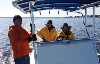
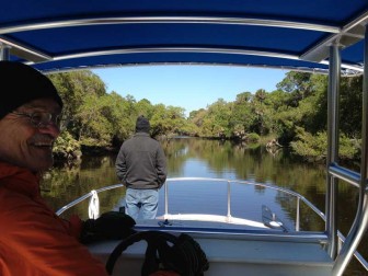
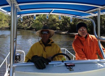
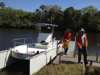
On March 15 of 2013, we decided to get an early start and go until we ran out of navigable water or time, whichever came first. The crew for the day, pictured at right, were Don, Fred, Mike (in whose cow barn the boat was built), and me. We got away from the dock at 9 am after a small delay involving Fred getting new tires. Waiting an extra hour to depart was not such a bad thing because it was a very cold morning.
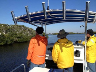
The lower Myakka River between US 41 and SR 776 is a mangrove estuary with shallow water, sand and oyster bars, and small mangrove islands. One of those islands, pictured at left, is a bird rookery and every branch that could support a nest had wood storks, herons and other types of birds on it. These islands are interesting and the birds are beautiful, but the smell is terrible if you get downwind!

A short distance past the bird rookery island we came to the US 41 bridges, with the Myakka River Oyster Bar on the western shore at the bridge. It was too early to stop in, but Don told us they make a great fish taco and stopping on the way back was in the plan. Just past the bridge, there is a large sand bar right in the middle of the river. Don had successfully driven right over it before, but he must have come at a higher tide. I saw the color of the water changing from dark brown to tan and decided it was a good time to hang on to something, and not a moment too soon. We hit bottom and had to tilt the engines up to get out to deeper water along the side of the river.
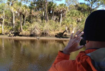
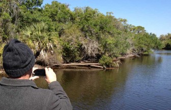
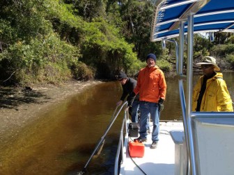
The river winds through some grassy marshes for a while and Mike spotted a wild pig along the shore on the swampy side, then we came to the more scenic part of the river, where there are fewer houses, higher ground with trees on both sides, and the river starts to get narrow. We started to see alligators basking on the sunny sections of shoreline, and lots of them. At right, Don is taking a picture of one of these alligators, which were the fattest, healthiest looking wild alligators I have ever seen, and I live in a swamp filled with alligators!
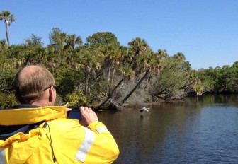
We were passing through a wild section of the Myakka leading up toward the Interstate 75 bridges with forests of cabbage palms, oaks and pines on each side when Mike spotted a Great Blue Heron fishing from a log on one side of the river. We approached slowly so he could take some pictures and I snapped the picture at left just as the bird took off and flew a short distance up the river. That bird kept flying on ahead of us every time we approached for a while.
Soon we passed by the Snook Haven restaurant, located at the end of East Venice Avenue. It was still pretty early to stop in but was on our itinerary for the return trip later in the day.

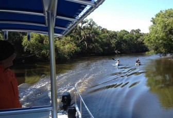
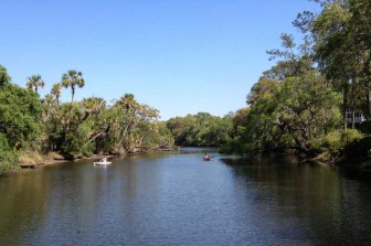
Kayaking on the Myakka River seems to be a very popular activity and we passed several kayakers throughout the day. Since the river has so many shallow spots and is uncharted and unmarked above US 41, only small powerboats venture up it and they are fairly rare. All of the kayakers seemed very surprised to encounter a 27 foot power catamaran coming up the river. I would have been too, but the Cowmaran is a very special powerboat so the normal rules of thumb do not apply.
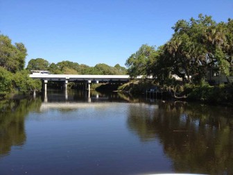
Shortly after passing the kayakers in the picture, we came to the I-75 bridges over the Myakka River. We were entering unexplored territory, at least for all of us and for the Cowmaran.

Past I-75, the Myakka snakes past a rural neighborhood on the right and woods on the left side for a mile or so, then there is another half mile section with forest on both sides. Don seemed to be having a great time exploring the wilds of Florida in his boat! Mike took in the scenery from up on the bow, watching for turtles and gators and trying (mostly successfully) to make sure we did not hit submerged logs or sand bars.
We encountered a some more pairs of kayakers in this section, two of whom are pictured at left. On the right side of the photo, you can see one of the houses nestled up in the trees on the bank. Even though we were passing through a neighborhood on one side of the river at this point, it felt like a wild river with no one around for miles except the kayakers and the Cowmaran crew.

In the wilderness section of river between I-75 and Border Road, Mike photographed one of the large population of turtles that we saw basking on fallen cabbage palm trunks. The alligators on the Myakka were fat and happy and did not seem at all disturbed by the passage of the boat, but these turtles were easily spooked. If you point at them or aim a camera at them, they jump in the water and disappear. This large one hung out on the log just long enough for me to get a picture of Mike taking his picture before diving into the river.
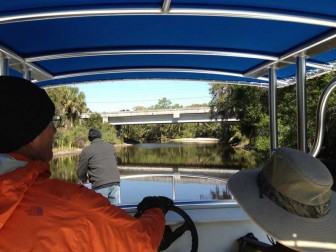
Don had driven a car up to the Border Road bridge a week or so earlier to see whether it was tall enough to clear the T-top on the Cowmaran and thought it a bit questionable, but as we approached we could see that we had a couple of feet to spare. If the river were really high, as it is at times during the wet season, this would have been the end of the journey for the Cowmaran, but we were able to continue on up river.

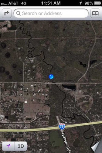
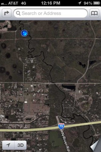
Just past the Border Rd bridge, it occurred to me to take this screenshot of my iPhone map showing where we were. The NOAA chart ends at US 41, so the Cowmaran's GPS had been showing us advancing across dry land for quite a while, but the iPhone knew where we were and had a satellite image of the area showing the river's twists and turns.
Technology can be pretty handy sometimes! I decided to take more screenshots at points of interest along the way.
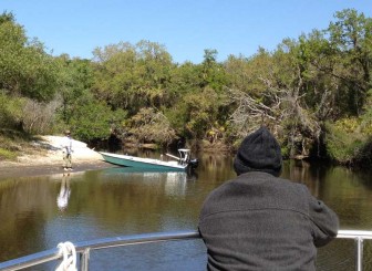
Coming around a river bend, we saw a fisherman with his skiff pulled up on shore. We had seen the tour boat from Snook Haven down below I-75, but this was the only other powerboat we saw up the river this far. Like all of the kayakers, he seemed a bit stunned to see a 27 foot catamaran coming up the river. I noted with some amusement that his little skiff, with its 20 hp engine, actually had more power than the Cowmaran, which has twin 9.8's. With a somewhat larger lower unit and propeller, it probably draws slightly more water too.

Fred took a turn at driving the Cowmaran for a while in the stretch above Border Rd. The Myakka River is so wild and beautiful up in this area that it made us imagine it probably looked about the same as when Spaniards first came to Florida hundreds of years before, and probably long before that. The Cowmaran has a depth finder and we were sort of surprised that most of the river in this area was about 5 to 8 feet deep. I expected it to be shallower.
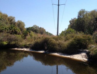
Soon we came to a landmark that would not have been present in Spanish colonial times: an overhead power line. It was kind of incongruous out in the wilderness, but was only a momentary interruption in the scenery.

A couple of bends past the powerline, we came to a shallow spot in the river. Most of the Myakka in this area was a pretty constant depth, as mentioned above, but there was a sand bar right in the middle of the river, with slightly deeper water in narrow channels on each side. We tried to go through the right side channel, but it was so narrow that one hull of the 8'6" wide Cowmaran was almost on the shore and the other was too close to the sand bar. We had to tilt the engines up and make our way through using the boathook and paddle. Note for future exploration missions: more than one paddle would have been a good idea!
We entered a "Man Overboard" mark on the GPS to alert us to the shallow spot on our return trip down river. Although there was no chart for this area, the GPS was still leaving a breadcrumb track along our route and the MOB point would be easy to see on the way back. I also marked the spot with another iPhone screen shot, shown at left.
The straight line just below the blue dot indicating our position is the powerline.

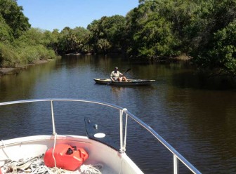
A few minutes later, we came around a bend and saw this man fly fishing in a small canoe. The rest of the paddlers we encountered in the Myakka were friendly, if a bit confused by our presence. This guy was rather grumpy. He probably figured he could avoid all contact with powerboats by fishing in such a remote part of the river, so the last thing he expected was a large catamaran coming up river. The Cowmaran is not your ordinary large catamaran, and can go places others would not dare to try!
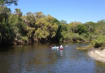
A little further up the river, we passed these two women kayaking upstream. I am still wondering where all these kayakers launched their boats. They are probably still wondering how those guys in the big catamaran found their way so far up the Myakka!

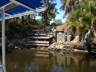
The river was getting more narrow and the submerged remains of fallen trees were becoming more common as we went upstream. We had already bounced off a couple of underwater snags when we came to a bend in the river with this private dock. It was a sharp bend with several snags and a sand bar just upstream that looked a bit difficult to negotiate. It was also starting to look increasingly difficult to find a spot large enough to turn a 27' boat around. We were debating whether to continue when I pointed out that we probably should not go into places where we can't turn around unless we want to come back out backwards. With that remark, Don made the call to turn back, so this was as far as we got.
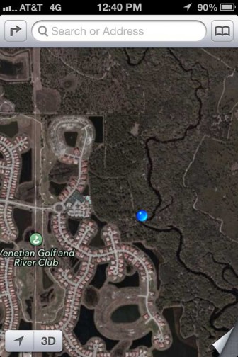
I marked our turnaround point with the screen shot at left. The "No Trespassing" sign on the dock said it was for club members and guests only, causing us to wonder which club was located up here in the middle of nowhere. The iPhone picture revealed two answers: the dock belongs to the Venetian Golf and River Club, and there was a whole neighborhood just beyond the trees, so we were not exactly in the middle of nowhere. More on the edge of nowhere!
Turning around in the river bend turned out to be a bit tricky and involved pushing off logs and the shore with the boathook while spinning the boat using reverse on one engine and forward on the other. The river above that point appeared even less navigable, so it was probably a good time to head back. We decided that for further exploration up the Myakka, a good plan would be to bring kayaks along on board the Cowmaran and use it as a base camp from which to kayak further up river.

The return trip down the Myakka was fairly uneventful and I drove the boat a good portion of the way, so did not take pictures. We pushed our way back over the shallow spot again, saw lots more gators and turtles basking, saw several kayaks, including some of the same ones from our trip up, who asked how far we had gotten. They were amazed that we had made it to the Venetian Golf and River Club. Many of the oak trees overhanging the river were covered with airplants, ferns and various epiphytes, but I only saw one that had a wild orchid, which was kind of surprising since they are fairly common on Shell Creek and its tributaries around our house.
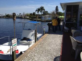
We had eaten some wrap sandwiches from Publix and snacked on nuts throughout the day, but as the afternoon wore on it was time for more serious nutrition so we stopped at Snook Haven just below the I-75 bridges for a pitcher of beer. The docks were not built for boats as large as the Cowmaran and the port bow is actually pulled up onto the shore in the picture at right.
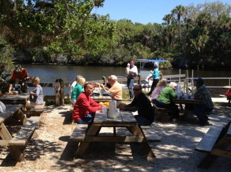
Snook Haven was kind of an eclectic and funky place, with a live band playing and people of all ages eating and drinking at indoor and outdoor tables. At right is a shot of Fred and Mike at our picnic table, waiting for Don to return with the pitcher of beer.

We decided not to eat at Snook Haven since Don had in mind eating at the Myakka River Oyster Bar. It is a few miles further down the river, next to the US 41 bridges. We got there a little after 3 pm and I took this picture of the Cowmaran at their dock. That's the crew walking away into the shadow of the building.
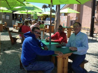
We ordered fish tacos and fried oyster sandwiches for lunch and sat at an outdoor table. Mike was feeling bad that I was not in any of my pictures for the day, so he took this picture of Fred, Don and me as we waited for our food.

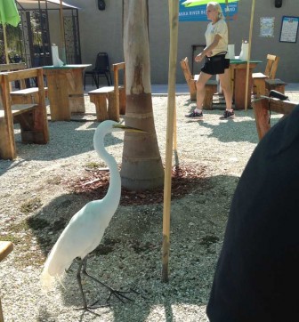
Also waiting to be fed were a couple of extremely tame birds that were obviously being fed by some of the patrons of the restaurant on a pretty regular basis. The large White Egret at right was particularly bold, wandering around between tables full of people and looking for anything that might be left on the ground. I saw him nab a few french fries off a plate as some diners left, before the waitress returned to pick up their plates.
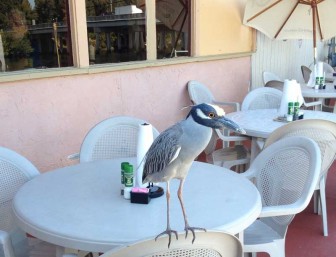
Out on one of the tables by the dock was this Yellow Crowned Night Heron, who had also greeted us as we arrived. I suspect this fellow was not so interested in french fries, but was accustomed to being fed unused bait by fishermen who stopped in for a bite.

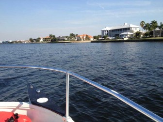
After a delicious lunch, we headed on down the lower Myakka River and across Charlotte Harbor, back to Don's place in Punta Gorda Isles. As we approached, we saw something large jumping in the PGI channel. At first I thought it must be a tarpon that had broken a fishing line and was trying to throw a hook out of its mouth. It was quite large and silver-grey and there are not all that many really large fish in the harbor. As we got closer, we could see that it was actually a wild dolphin jumping in the channel.
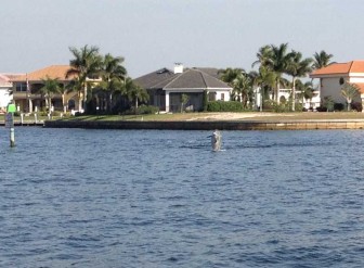
Not sure whether the performance would continue, I decided not to try to get out my video camera and instead just aimed my iPhone camera at the area, hoping for one more jump. That jump came and I clicked the shutter button. The picture at right is the result.
Since it is so hard to see the dolphin in that picture, I cropped in on the 800 pixel area around the dolphin to get the version at left. It's not the best dolphin jumping picture I have ever seen, but it's not that bad for a quick shot with an iPhone and it is the best one I have ever taken myself!
We arrived back at Don's dock at around a quarter to 6, just under 9 hours after we departed. We had covered an estimated 78 miles and it turned out that we did not need the 6 gallon fuel tanks at all. Both engines ran on their individual 3 gallon tanks all day long. The trip consumed about 4.5 or 5 gallons of gas, meaning the Cowmaran averaged 15 to 17 miles per gallon. That's better than my truck!
Excellent boat creation….Maybe you will consider adding solar laminate panels as a sun shade and power the boat from DC power. You could get an almost infinite range. Sunelec.com in Miami has these SUN 395 Watt Monocrystalline 4×8′ panels for $0.44/watt or about $175 per panel. The gas motors could be your backup in case of darkness if you choose not to use any batteries. Thanks for sharing.
http://sunelec.com/solar-panels/sun-395-watt-monocrystalline-solar-panel.html
builditsolar.com has lots of links for electric car projects that might also be helpful.